Run Date: Saturday June 4th Trail Organizer: Jack & Zoe RSVP: YES, call or text 909-213-6787
Permits Required: Yes, Adventure Pass. Annual $30 or day pass $5, available at most local grocery/gas stations, as well as Ranger stations and Big Bear Discovery Center.
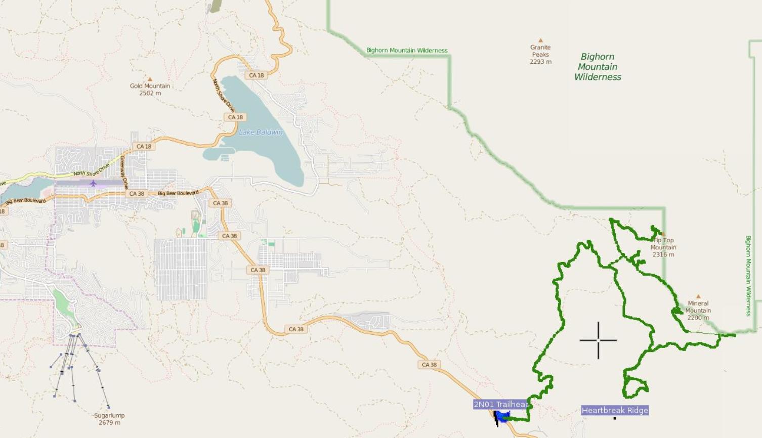
Meeting Time: 8:30am. Go over rig readiness and trail plan, leave at 9:00am. Day trip only. Meeting Location: We will meet at McDonald's (Highway 38 AKA 1796 E. Lugonia Ave and Wabash Ave crossroads, Redlands, CA 92374). From there, we will drive to Big Bear (near Angelus Oaks area) to 2N01 Trailhead (near Burns Canyon) and then on to 2N61Y (Heartbreak Ridge).
Trail Description: Total apx. ~20 miles (allow 4 to 5 hours). You can expect to encounter large boulders, tippy terrain, steep shelves/roads and sharp rock on sections of the trail. The US Forest Service rates this trail a Black Diamond Most Difficult trail and it is not recommended for stock SUVs. Body damage and breakage are possible. Elevation ranges from 6,000' to over 8,000'. If there is time we will also complete 2N70Y, make a stop at Rose Mine and climb Tip Top Mountain (2N90).
Difficulty: (1=Easy, 5=Most Difficult) Rated #4, due to boulders, sharp rocks, steep shelves/grades and deeply rutted roads on sections of the trail. The rest of the trail is easy with a couple of moderate obstacles. Some obstacles have bypasses and some don't.
CB Channel: 4
Special Equipment Required: High ground clearance, rear lockers, skid plates and 33 inch tires or larger *required*.
Reminder to Bring: Bring lunch, snacks and extra water, chairs, tools, shovel, camera, extra weather appropriate clothing, etc.
Weather: If heavy wind or rain the trip will be canceled.
Trail Head Coordinates: Start: Highway 38 and USFS 2N01. Lat/Lon (degrees/minutes/seconds) 34° 12' 26.32'' N 116° 44' 16.62'' W Lat/Lon (decimal degrees) 34.207310 -116.737950 Finish: Same as trail head.
Departure: We will exit the way we came (2N01 and Hwy 38).